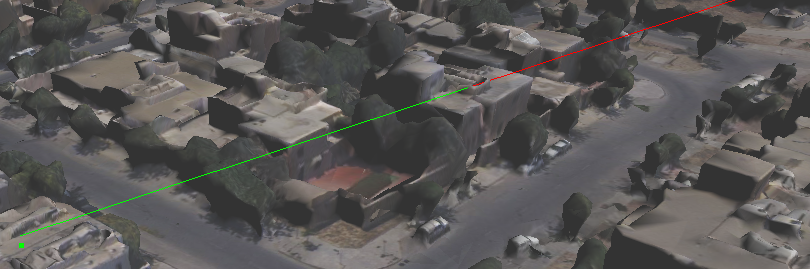
Line of Sight is an imaginary straight line joining the centre of the observer's eye with the object being viewed. Line of sight varies with the source and target location, and are obstructed by taller objects. The Line of Sight command allows you to identify the visible and invisible parts along the line from observer location to destination. The area visible appears is represented by green and area invisible by red.
 |
|
3.
|
If the Map tools pane is not expanded, in the map viewer, click the Map Tools button.
|
|
4.
|
On the Map Tools pane, click the More Tools button and then select Line of Sight. The Line of Sight dialog box appears.
|
|
5.
|
Click the icon next to the Start Point field and click a location on the map. The Start Point field gets populated by the coordinates of the selected location.
|
|
8.
|
Click the icon next to the End Point field and click a location on the map. The End Point field gets populated by the coordinates of the selected location.
|
|
9.
|
Click Show.
|