You can add locally stored ESRI shape files, KML and GPX files (locally stored or accessible through a URL), or web map services (WMS) to the currently displayed map. You cannot upload more than one set of map data at a time to the map.
|
•
|
On the map viewer toolbar, click the Add Local Data icon
|
|
•
|
If you have added local map data to the currently displayed map, you must remove it by clicking the Clear Local Data icon
|
 |
|
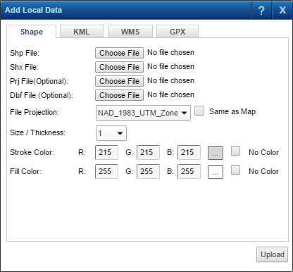
Click Browse to locate the shape file (.shp file) that you want to view on the currently displayed map.
|
|
|
Click Browse to locate the shape file index (.shx file) that accompanies the shape file you selected in Shp File.
|
|
|
If a .prj file accompanies the shape file, click Browse to locate and select it.
|
|
|
If a .dbf attribute data file accompanies the shape file you selected in Shp File, click Browse to locate and select it.
|
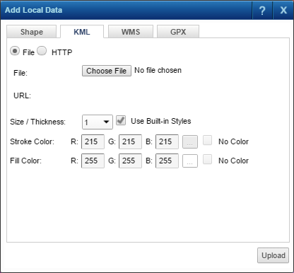
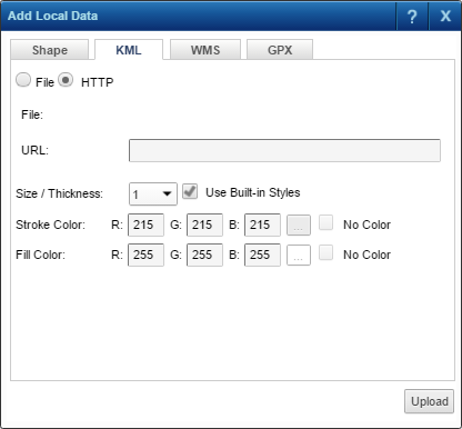
Select either File to upload a KML file to the currently displayed map or HTTP to upload a KML file identified by a link to the currently displayed map. KML files are written in the Keyhole Markup Language, an XML-based language provided by Google for the display of map features and raster images in 2D and 3D.
 |
|
Click Browse to locate the KML file (.kml) that you want to view on the currently displayed map.
|
|||||||
|
If this option is selected, the symbol style settings in the KML file are given precedence, and Size/Thickness, Stroke Color and Fill Color are not available.
|
|||||||
|
Select the size or thickness in pixels at which you want the map features to display. The default value is 1.
|
|||||||
|
Specify the RGB color for the contour of the map features or click the Edit icon to select a color.
|
|||||||
|
Specify the RGB color for the fill of the map features or click the Edit icon to select a color.
|
If you select the HTTP option to upload a KML file named in a URL, the KML file must have the .kml file name extension. See the example below.
 |
|
Specify the URL (HTTP path) of the KML file you want to upload. The file name extension of the KML file must be .kml.
|
|||||||
|
If this option is selected, the symbol style settings in the KML file are given precedence, and Size/Thickness, Stroke Color and Fill Color are not available.
|
|||||||
|
Select the size or thickness of pixels at which you want the map features to display. The default value is 1.
|
|||||||
|
Specify the RGB color for the contour of the map features or click the Edit icon to select a color.
|
|||||||
|
Specify the RGB color for the fill of the map features or click the Edit icon to select a color.
|
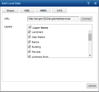
You can upload a web map service (WMS) and view it on the currently displayed map. Either all layers or specific layers from the WMS can be uploaded to the current map.
|
•
|
In URL, specify the HTTP path of the WMS you want to view and click Connect. If the connection to the WMS is successful, the layers contained in the WMS appear in the Layers list box.
|
|
•
|
In Layers, by default all layers in the WMS are selected to be uploaded. Unselect those layers you do not want to upload. Selecting the Layer Name check box will select all unselected layers at the same time.
|
 |
|
•
|
Click Upload.
|
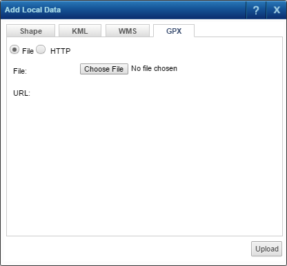
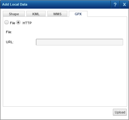
Select either File to upload a GPS Exchange Format (GPX) file to the currently displayed map or HTTP to upload a GPX file identified by a link to the currently displayed map. GPX files are in XML data format and, is used for sharing and exchanging GPS data between different users and programs.
If you select the File option, click Browse to locate the GPX file that you want to view on the currently displayed map. The GPX file you upload must have the .gpx file name extension.
 |
If you select the HTTP option, specify the URL (HTTP path) of the GPX file you want to upload. The file name extension of the KML file must be .gpx. See the example below.
 |