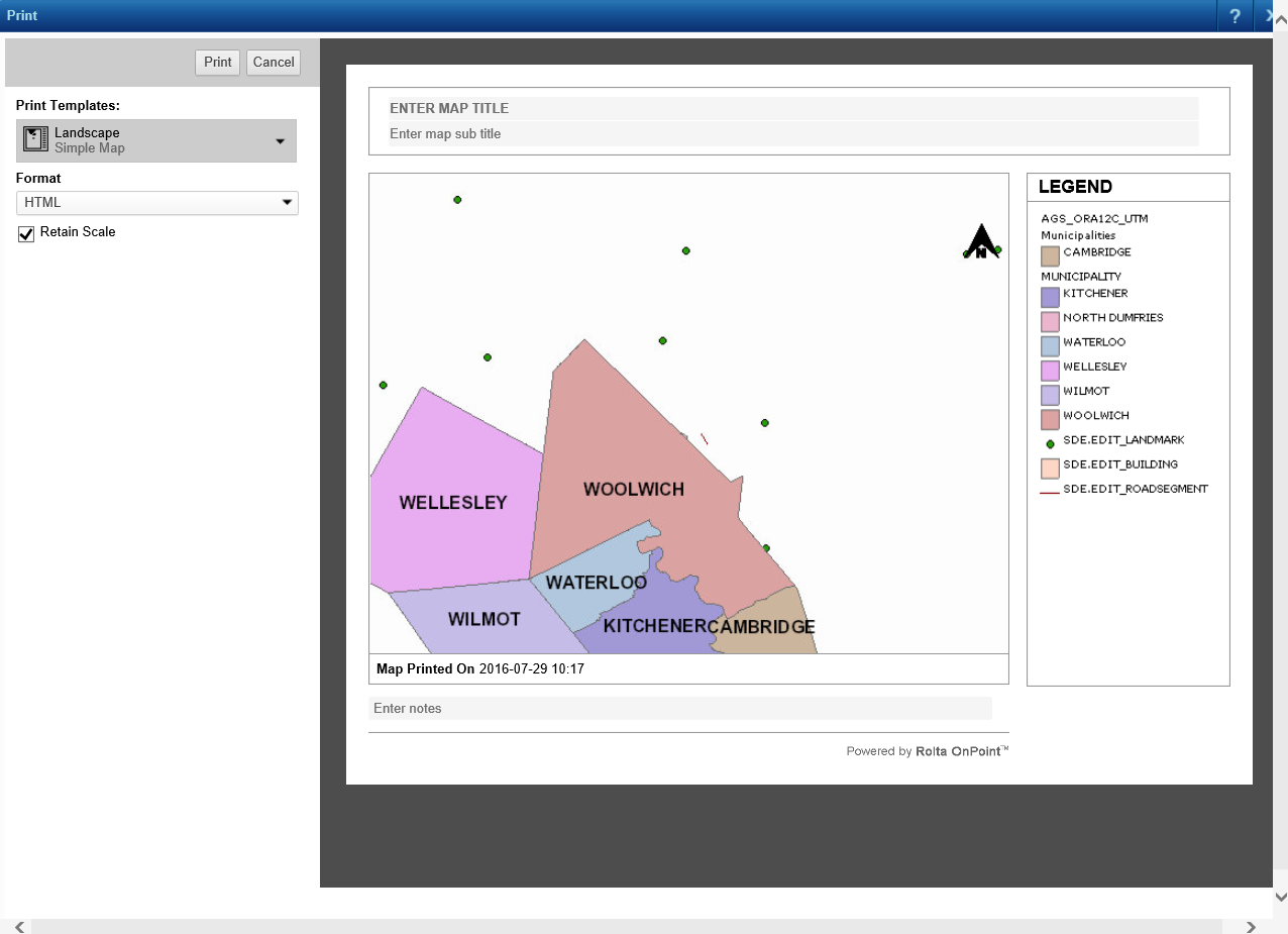
The Cartographic Map print template gives you more print options to determine the print output than the other print templates. You can select the resolution of the map image, the image format of the print file and the scale of the map. You can also reorder layers or omit layers from the print map.
|
1.
|
On the Command bar, click the Print icon
|
 |
|
2.
|
 |
|
3.
|
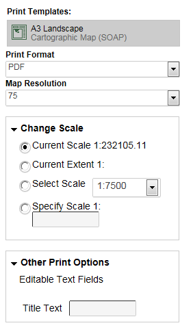
From the Print Format drop-down list, select the output format. The default format for the printable file that is generated is PDF. The following table lists the other formats that are available.
|
|
Print format
|
|
|
An .ai is a vector-based graphic that allows resizing without loss of quality. This format is suited to high-quality printing where high resolutions are important, or where the image will be scaled or edited in the future. AI is a proprietary format of Adobe Illustrator.
|
|
|
An .eps file is a vector-based graphic format that allows resizing without loss of quality. This format is suited to high-quality printing where high resolutions are important, or where the image will be scaled or edited in the future. This format is often used in professional publishing and requires an illustration or layout program to be viewed.
|
|
|
A .gif file is a raster format best used for low-resolution, color-limited images with sharp edges. This format is also useful for images with areas of flat color.
Images in this format are 8-bit images containing 256 colors and can contain a transparent area. This is the most common web graphic format.
|
|
|
A .jpeg file is a raster format that is best used for web images with gradient colors or images that require more than 256 colors. This format handles photographic material and textures better than .gif.
Images in this format are 24-bit images that can contain millions of colors. The .jpeg format compresses images 2 to 3 times smaller than .gif.
|
|
|
A .png file is a raster format that will eventually replace .gif because it offers better color depth that .gif and smaller file sizes than .jpeg, though .jpeg provides better quality for photographic images.
This format offers 8-bit palette indexed color, 16-bit grayscale images and 48-bit true color. A .png image can contain transparency and is the most versatile of all web graphic formats.
|
|
|
This is a format for object-based images for the Internet not intended for printed documents.
|
|
|
A .tiff file is a raster format that preserves image quality well but file sizes can be large.
|
|
4.
|
From the Map Resolution drop-down list, select the resolution of the printable map image that will be generated. By default Map Resolution is set to 75.
|
|
5.
|
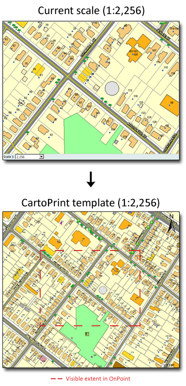
Expand the Change Scale section and select a scale from one of the options. By default the scale of the map to be printed is the same as the currently displayed map.
|
|
By default this option is selected. The scale of the printable map will match the scale of the currently displayed map.
|
|||
|
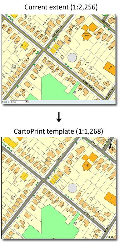
The map area of the print layout will show map data from the current map extent displayed in the map viewer. The scale of the map in the printable file will vary from the scale shown on the currently displayed map.
|
|||
|
Specify the scale at which you want the map on the printout to be shown.
|
 |
 |
|
6.
|
Expand the Other Print Options section. If any editable labels have been configured for the print template, they are listed here. In the example shown in Figure 47 , a Title Text label field appears.
|
 |
|
7.
|
Click Print. The following message appears in your browser, directing you to a link you can click to preview the printable map.
|
|
|
|
Sometimes, when printing cascaded map services where the base map is provided by Bing, the base map may not appear in the print preview; even though it appears in the output.
|