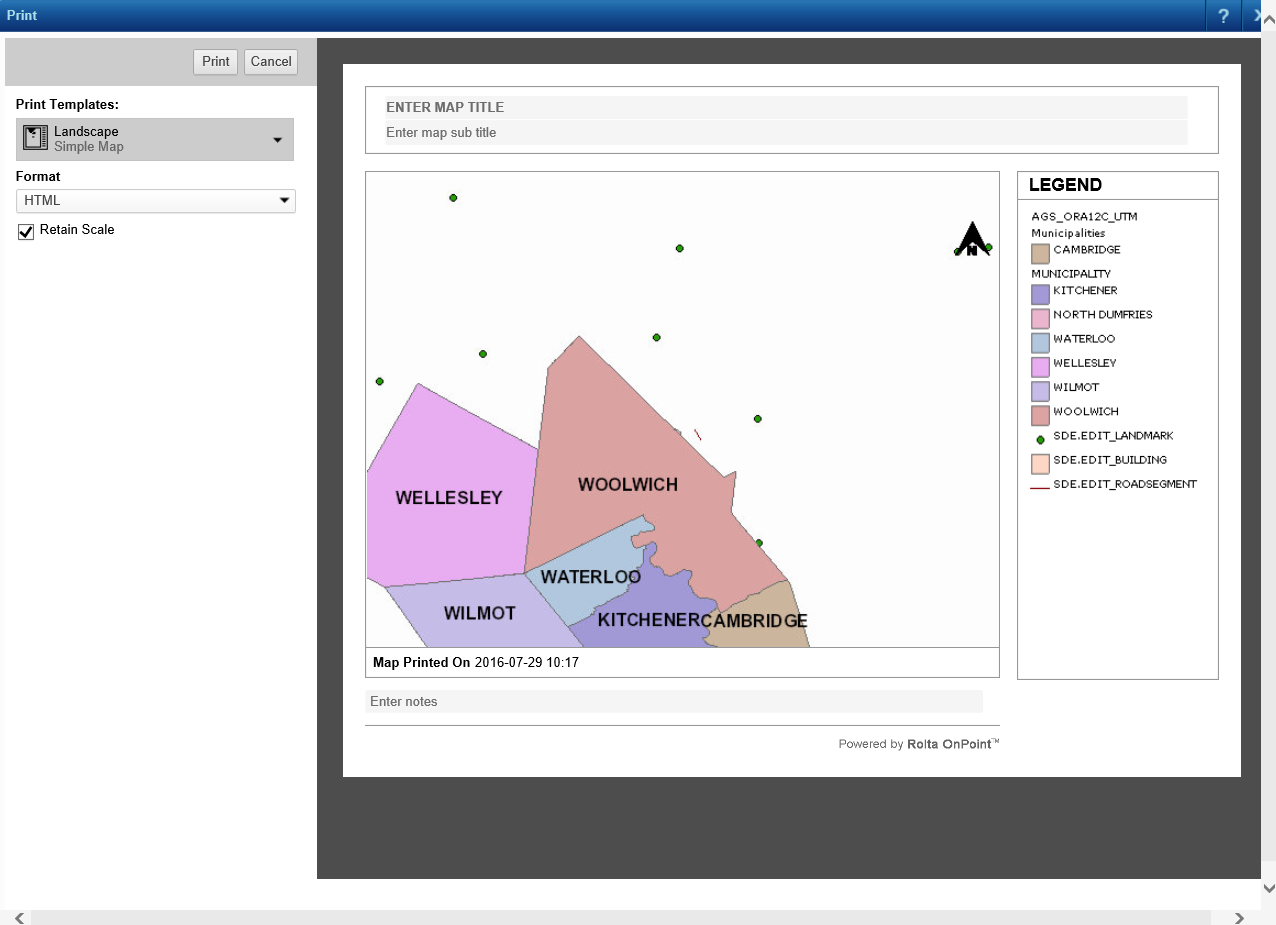
The Cartographic Map Series print template gives you these options to generate a series of printable maps of features on a preselected print layer:
|
•
|
Generate one map for every feature on the preselected layer within the currently displayed extent of the map.
|
|
1.
|
On the Command bar, click the Print icon
|
 |
|
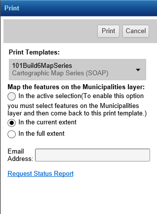
If you want to generate individual maps of the features in the active selection, you must make a selection first before clicking the Print Map icon.
However, you must also know which layer in the map is the layer from which features can be printed. If you have not been told by the map administrator, you will have to proceed until step 3. At that point, the Print window displays a message at the top indicating the layer from which features can be printed. Note the layer and close the Print window. Make the selection ensuring that the print layer is the active layer and then begin this procedure again.
|
|
2.
|
 |
|
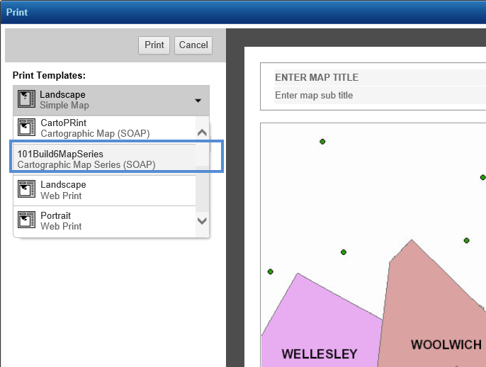
3.
|
Select one of the Cartographic Map print template print options that appear in the Print window. The following table describes the print options.
|
 |
|
One printable map for each feature currently selected on the predefined print layer will be generated.
|
|||
|
One printable map for every feature on the predefined print layer within the currently displayed extent of the map will be generated.
|
|||
|
One printable map for every feature on the predefined print layer within the full extent of the map will be generated.
|
|
4.
|
In Email Address, specify an e-mail address where it would be convenient for you to receive a notification e-mail informing you of the link you can use to access the printable map files that will be generated.
|
|
5.
|
Click Print. The Print window displays the request ID for the map series and indicates that the location of the generated map files will be sent to the e-mail address you specified.
|
|
6.
|
To view the status of the map series request, click the Request Status Report hyperlink in the Print window. The CartoPrint Queue Status window appears.
|
|
8.
|
To view status details of the print requests for the features in the map series, you can select any one of the following options.
|
|
Select this option to view status details for print requests for all the features in the map series. By default this option is selected.
|
|
|
Select this option to view status details of the print feature requests that were successfully completed.
|
|
|
Select this option to view status details of print feature requests that have yet to be processed.
|
|
|
Select this option to view status details of print feature requests that failed.
|
|
9.
|
From the Rows Per Page drop-down list, select the number of print requests that you want displayed on each page in the CartoPrint Status window. By default the value selected is 20.
|
 |
|
10.
|
Click Show Status. In the lower section of the CartoPrint Status window, the status details of the print requests for the features are displayed in six columns.
|
|
This column displays the file name of the printable map file for the feature.
|
|||||||
|
This column displays the status of the print request for the feature in the map series. The file status is set to either of the following values:
|
|||||||
|
Status Message
|
This column displays a message that indicates whether the printable map file was successfully generated.
|
||||||
|
Request Time
|
This column displays the time when the print request for the feature was generated.
|
||||||
|
Last Update Time
|
This column displays the time when the print request for the feature was last processed.
|
|
If you know the request ID of a particular map series, you can view the status of that map series by using the Request Status Report link. This link appears in the Print window that opens immediately after you select the CartoPrint Map Series print template. After you click the link, the CartoPrint Status window appears wherein in you must specify the Request ID and click Show Status. The status details of the print requests for the features in the map series are then displayed.
You can also select from the options that appear whether you want to view all the print requests (All), print requests that have been successfully completed (Finished), print requests that failed (Error), or print requests that have yet to be processed (Pending).
|