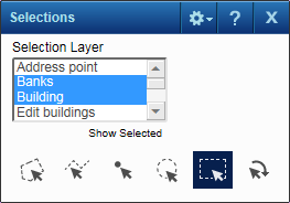
If your site administrator has enabled this functionality, you have the option of selecting features from multiple layers or feature groups. You know this functionality exists if you see a list box on the Selection window.
|
1.
|
|
2.
|
On the Map Tools pane, click the More Tools button and then click Selection. The Selections window opens The Selections window opens.
|
 |
|
3.
|
In the Selection Layer field, select the type of map feature you want to view. You can select features from multiple feature groups or layers by holding the Ctrl key as you select.
|
 |
|
5.
|
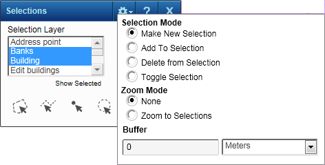
In the Selection Mode field, select the option that defines how items are added or removed from the list when you select features on the map. The options are the following:
|
|
•
|
Make New Selection. This option creates a new selection group or replaces an existing group of the same type.
|
|
•
|
Toggle Selection. This option both adds new items to the list and removes previously selected items from the list.
|
|
6.
|
In the Zoom Mode field, select either Zoom To Selections to have the map zoom in or out to show all the results or None to have the map remain at the current map scale.
|
|
7.
|
In the Buffer fields, you can optionally enter a buffer area by the distance you specify around each selected item.
|
|
|
Select by polygon
|
Allows you click several points on the map to create a polygon (double-click to complete the shape). All items for the selected group (layer) within the polygon will be included in the list.
|
|
|
Allows you to click points on the map to draw multiple connected lines that includes all features from the selected layer if touched by the line (double-click to complete the line).
|
|
|
|
Select by point
|
Allows you to select a single item on the map for the selected layer.
|
|
|
Draws a circle that will include all items within the circle for the selected layer.
|
|
|
|
Select by rectangle
|
Draws a rectangle that will include all items within the rectangle for the selected layer.
|
|
|
Retrieve selections
|
Allows you to apply previously saved selections or results.
|
|
9.
|
Use the tool to draw the required shape. All items of the selected type within that area display in the Results window and on the map.
|
|
•
|
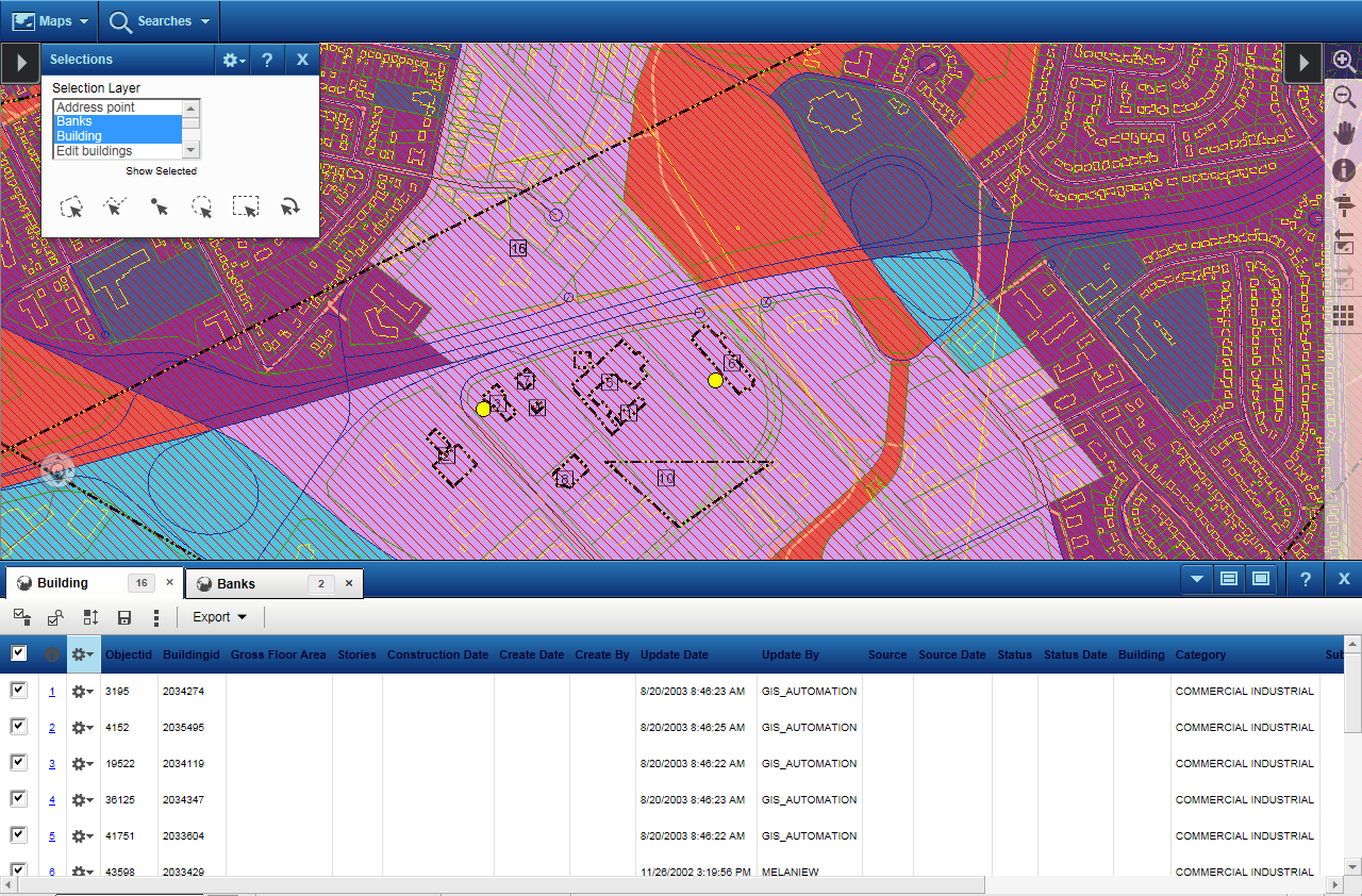
Figure 170 shows a selection that has been made on two feature groups or layers, namely Buildings and Banks. Notice a result set with tabs for features belonging to each feature group is displayed.
|
 |
|
•
|
In the Results window, you have icons that allow you to perform additional actions. See Table 18 for descriptions.
|