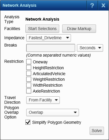
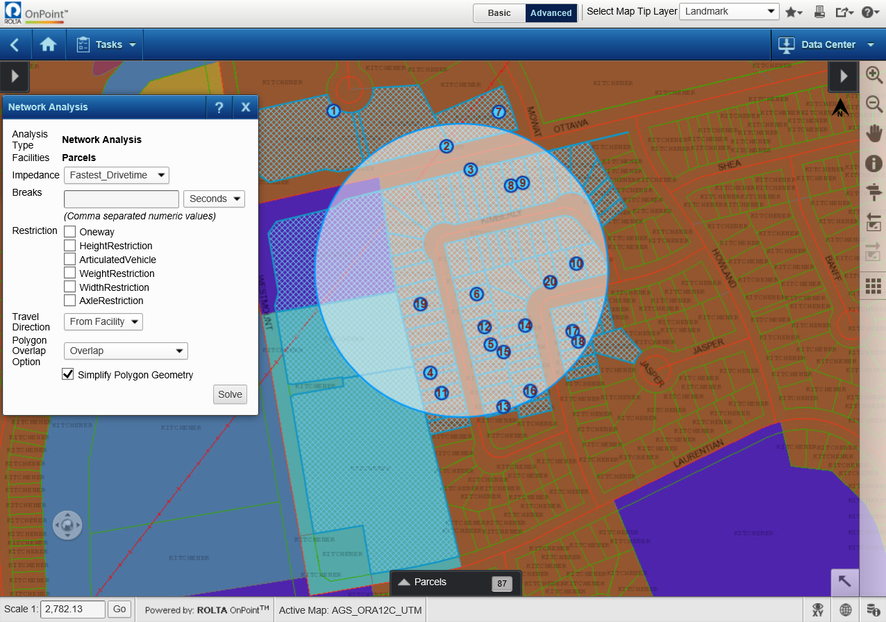
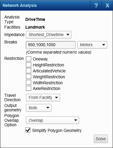
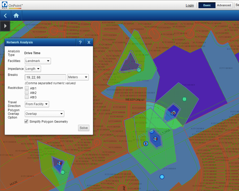
Advanced Tasks : Calculating service areas

Calculating service areas
A service area is a region that includes all streets that can be accessed within an impedance defined by time or distance from a point in a network that you choose on the map. For example, a 10-minute service area of a fire station would include all those streets that can be reached within 10 minutes from the fire station. Multiple service areas can also be overlapped. Perhaps you want to define a service area for a community center by seeing how many residences are within 1 km, 2 km, or 3 km radius of the community center.
 
NOTE: 
1.
2.
 
Figure 309 
3.
4.
a.
b.
Selecting a map feature to use as a focal point for the service area
 
Figure 310 
 
Drawing a map feature to use as a focal point for the service area
5.
 
Table 35 
For example, if you selected a school as the facility for which you wanted to calculate a service area, and set Impedance to Time, and specified 10, 15, 30 in Breaks and selected Minutes. Three concentric service areas would be plotted on the map, showing three concentric service areas radiating from the school from where travel time to the school is 10, 15 or 30 minutes.
 
Figure 311 
6.
 
Figure 312