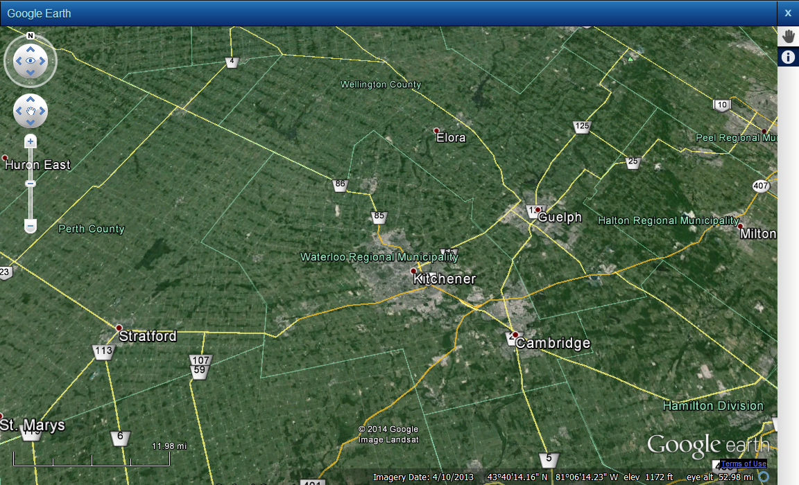
Google Earth is a three-dimensional map view provided by Google. If Google Earth has been enabled for your Google Map, an Earth button is displayed in top right area of the map viewer.
|
1.
|
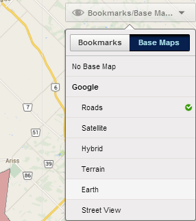
In the top right corner of the map viewer, click Bookmarks/Base Maps and then click Base Map. In Base Map, under Google, click Earth.
|
 |
 |
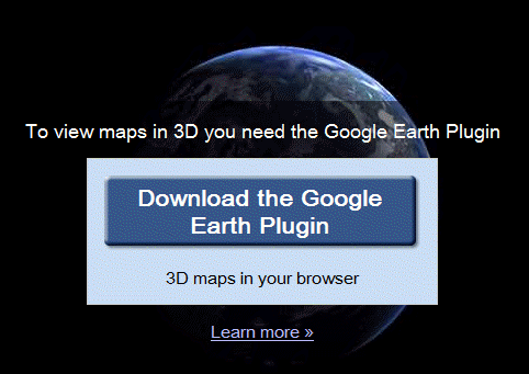
If you have not installed the Google Earth plugin previously, you are prompted to install the plugin required to view the Google Earth three-dimensional map when you click the Earth button in the map viewer.
|
1.
|
In the map viewer that currently showing a Google map, click the Earth button at the bottom left corner of the viewer. If you have not installed the plugin, the Download the Google Earth Plugin prompt is displayed.
|
 |
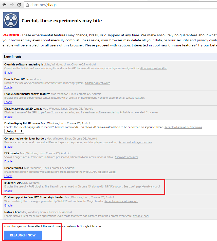
Since the web browser you are using is 32-bit Google Chrome and OnPoint 11.0 is 64-bit, you may encounter an error. To workaround this issue, enable the use of NPAPI plugins.
|
1.
|
In the address bar of Google Chrome, enter chrome://flags/ and press Enter.
|
|
2.
|
In the Enable NPAPI section, click Enable. The Relaunch button appears.
|
 |
|
3.
|
Click Relaunch and then follow the procedure to install the Google Earth plugin. This time you may be prompted to give your permission to run the plugin.
|
|
4.
|
Right-click on the map area and select Run this plugin.
|
Use the Look button to change the vantage point of the current view. Click an arrow or anywhere on the button to change the viewing direction and angle of the map.
 |
|
To rotate the map, click and drag the outer ring of the Look button. Click the N button to reset the orientation of the map to North.
|
 |
|
If you continue to zoom in, the vantage point tilts from its overhead position to be parallel to the ground.
|
When viewing a Google Earth and Street View maps, you can use the Pan tool to move the map in the direction you drag.
|
2.
|
Click the map while holding the mouse button and drag the mouse indicator across the map in the direction you want to move.
|
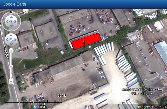
After selecting features on the map, you can view those selections in the Earth view of Google maps.
|
1.
|
|
3.
|
When the results display on the map and in the Results window, click Earth from the Base Maps drop-down list. Your selections are shown in the Google Earth map.
|
 |
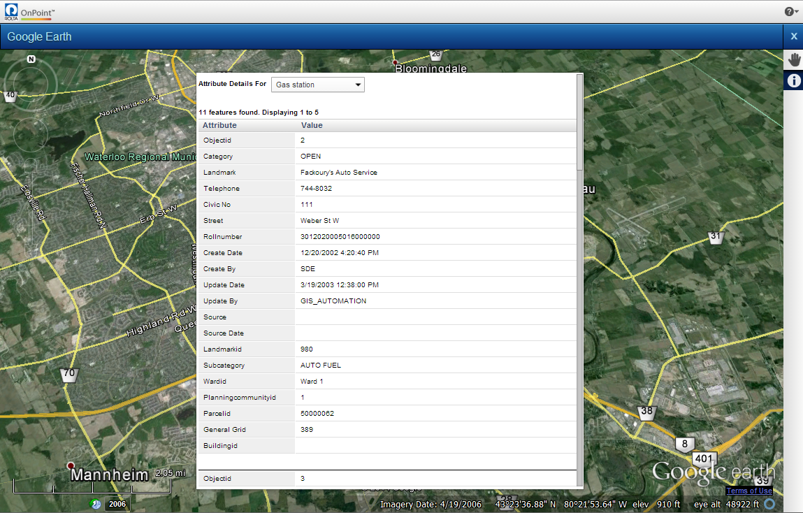
The Identify tool is available when viewing a Google Earth map. Similar to when you use it in other maps, the Identify tool shows you related or additional information about a feature on the map.
|
1.
|
On the Map Tools pane, click the Identify button
|
|
2.
|
In the Attribute Details For field, select a different feature type to display that type of information for the selected area.
|
 |
|
Google Earth maps may have historical data for a map area, but the Identify tool will not show historical information.
|