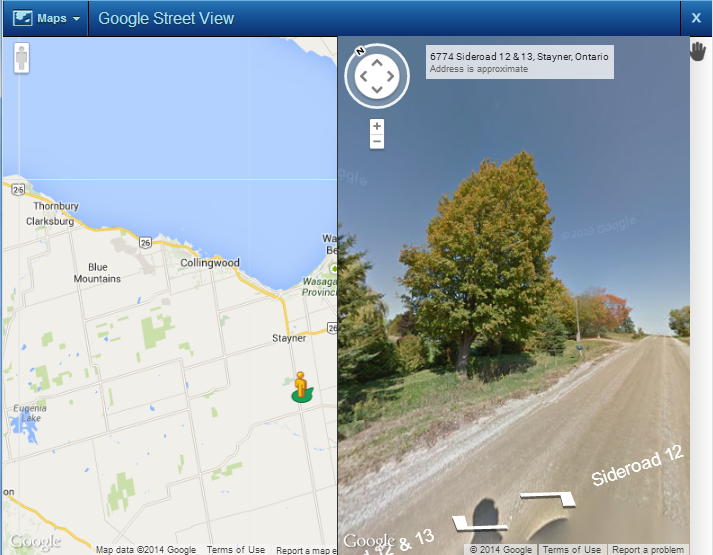
The Google Street View is a map that shows photographic images in all directions at street level. Navigation tools allow you to pan along the street and change the viewing direction. You can also use the Pegman icon  , which is displayed under the main Navigation button, to change the location of the street being viewed.
|
Google Street View may not have imagery data for all streets in the areas you are searching.
|
|
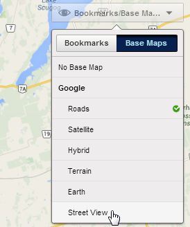
1.
|
From the Base Maps drop down list, click the Street View button.
|
 |
|
The position of the Google controls can be configured by your site administrator and may appear in a different position on the map viewer.
|
|
2.
|
Drag the Pegman icon to an area on a street that you want to view. Note that it is the green symbol under the Pegman icon that indicates the displayed area in the Street View window.
|
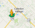 |
When you start to drag the Pegman over the map, all streets that have Street View imagery are outlined in blue.
 |