|
1.
|
|
2.
|
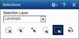
On the Map Tools pane, click the More Tools button and then click Selection. The Selections window opens.
|
 |
|
3.
|
In the Selection Layer field, select the type of map feature you want to view.
|
 |
|
5.
|
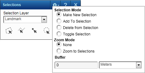
In the Selection Mode field, select the option that defines how items are added or removed from the list when you select features on the map. The options are the following:
|
|
6.
|
In the Zoom Mode field, select either Zoom To Selections to have the map zoom in or out to show all the results or None to retain the map at the current map scale.
|
|
7.
|
In the Buffer fields, you can optionally enter a buffer area by the distance you specify around each selected item.
|
|
|
||
|
|
||
|
|
||
|
|
||
|
|
||
|
|
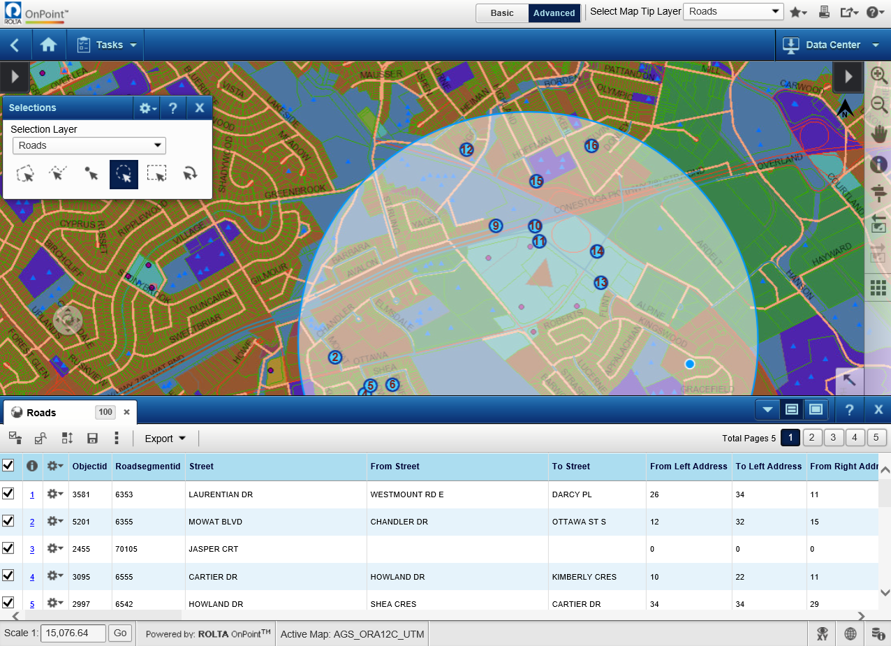 |
In the Results window, you have icons that allow you to perform additional actions. Only the first few icons display at the top of the window— additional icons for more tools are available by selecting the Results window, select the More drop-down menu  . See Using the Results window for more information.