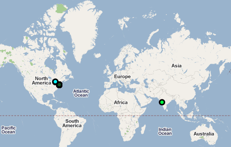
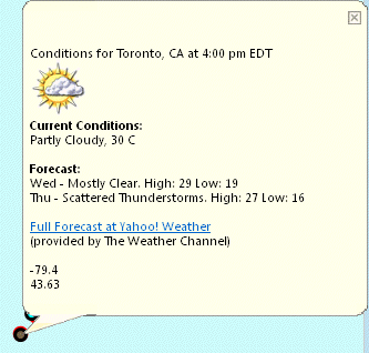
GeoRSS feeds are web feeds from the Internet that show data and provide an associated location for that information on the map. An example of a GeoRSS feed are weather forecasts that display symbols on the map for that location.
|
1.
|
|
2.
|
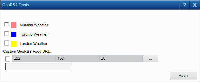
On the Map Tools pane, click the More Tools button and then select GeoRSS Feeds. The GeoRSS Feeds dialog box opens.
|
|
3.
|
Select the check box for the GeoRSS feed to display on the map. If available, you can also enter the web site address for your own GeoRSS feed by selecting the check box and then entering the web site address in the Custom GeoRss URL field.
|
 |
|
4.
|
Click Apply. A symbol displays in each location that has data from the GeoRSS feed.
|
 |
|
5.
|
In the Map Tools pane, click the GeoRSS icon
|
 |
In addition to viewing the GeoRSS feeds already available in the GeoRSS Feeds window, you can add your own GeoRSS feeds to display on the map.
|
1.
|
|
2.
|
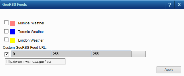
On the Map Tools pane, click the More Tools button and then select GeoRSS Feeds. The GeoRSS Feeds dialog box opens.
|
|
3.
|
Select the check box for the Custom GeoRss URL field and enter the full web address (http://...) for the GeoRSS feed you want to display.
|
|
4.
|
Select the color for the feed by clicking the Edit button
|
|
5.
|
Click Apply. The feed displays on the map.
|
 |
|
6.
|
In the Map Tools toolbar, click the GeoRSS icon
|