You know the map you are viewing is provided by a web map service if the WMS Identify icon  is available on the Map Tools pane.
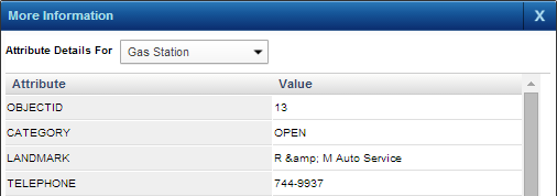
The WMS Identify tool displays additional information associated with a map feature on maps provided by a web map service.
|
1.
|
On the Map Tools pane, click the WMS Identify button
|
|
2.
|
From the Attribute Details For field, select a different feature type to display information for the selected area.
|
 |