 |
|
•
|
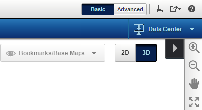
In the 3D mode, the Map Tools pane provides map tools for navigating and viewing information on a 3D map. As these tools in the pane are configurable by the agency or organization providing the map information, you may not be able to view all of the following 3D map tools..
|
|
Zooms in the map either by clicking the map or by dragging the tool across the map to draw a shape. The map is then zoomed in to the area defined within that shape.
|
|
|
|
||
|
|
||
|
|
||
|
|
3D Navigation
|
|
|
|
Displays information about a feature. Click the Identify tool and then click an area on the map. Select the feature type that you want to view and all information associated with that feature is displayed.
|
|
|
|
||
|
|
Determine distance by drawing a line or determine area by drawing a polygon, circle or rectangle.
|
|
|
|
||
|
|
Search by Coordinates
|
|
|
|
||
|
|
||
|
|
||
|
|
Flood Analysis
|
Helps to identify the effects of flood at different water levels on an area.
|
|
|
Helps to view the line of sight between source and target.
|
|
|
|
Area of Sight
|
|
|
|
Highest Point
|
|
|
|
Opens the online help of the OnPoint web-GIS application.
|